HAWK MOUNTAIN WAYFINDING SYSTEM
When:
Fall 2017
Class:
DCOM 351 – Prototyping
Programs:
Adobe Photoshop, PaintTool Sai
Credit:
Hawk Mountain Sanctuary Facebook for their Logo
The task for this project was to create a wayfinding system for a park or other area that requires navigation. Design should be consistent and efficient for users to find their way through a system. I chose Hawk Mountain Sanctuary, a hiking trail by my home to create a new system for. I visited the area and recorded some pain points with my brother and his friend to where improvements could be made.
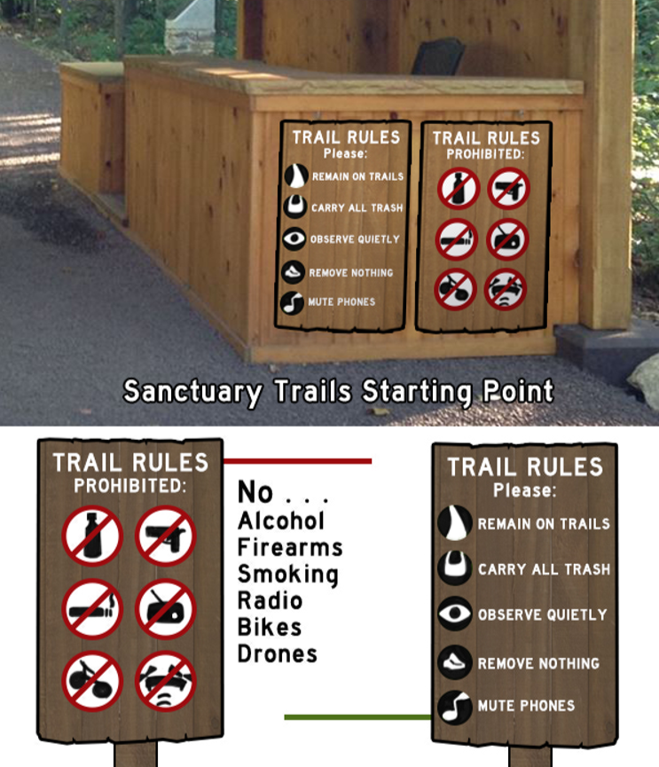
Rules & Regulations
As you enter the trail there needs to be more visual guides for what is or isn't aloud on the mountain. These should be located at the ticket gate, a natural point where people are waiting in line and have time to read these before getting their admission into the trail.
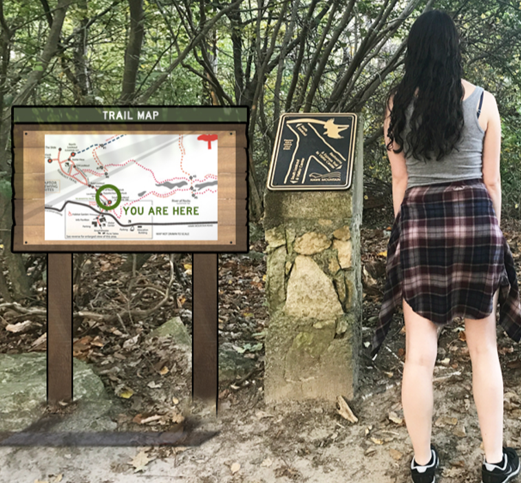
In-Trail Sign
You can see the signage that was already existing, nice as it is, does not depict any distances, only directions. For example, you would not know how far away you were from a bathroom – not a very useful map in that regard. So instead, I designed a map to withstand the elements, know where the user is at all times, and mimic the natural environment.
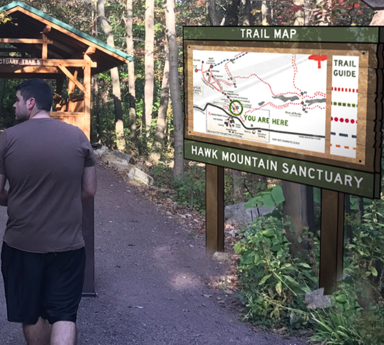
Main Trail Map
The larger version of the in-trail map shows great detail in a large scale by the entrance, so users can plan out their route if desired before they head out on the mountain.
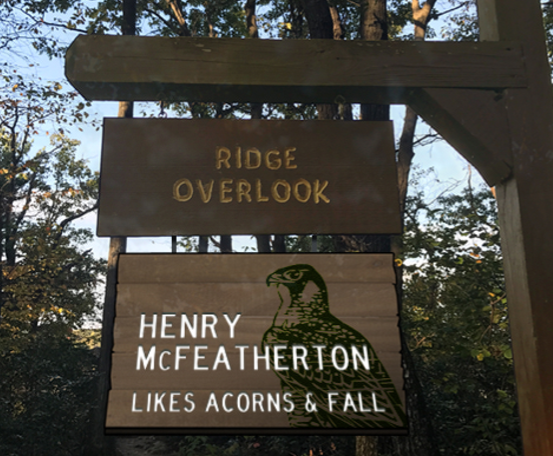
Mascots at Overlooks
The mountain has various overlook points throughout the trail, but the names could easily get mixed up. Japan uses cute mascots at their subway stations so it's easier for passengers to remember their stops. Using that same idea, by naming these overlook points with cute bird personalities, it will be easier for hikes to remember and find these points.
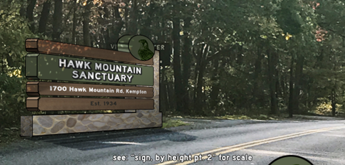
Road Sign
The existing road sign was small and tucked in behind trees, and easy to accidentally drive past. Instead, I designed a large and sturdy road sign to easily spot from the road.
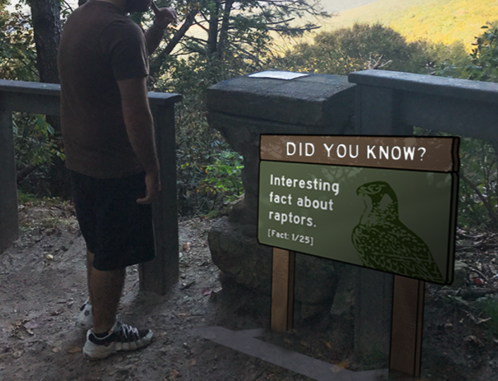
Fun Fact Signs
One of the last signs does not deal with wayfinding, but is an idea for hikers to discover more paths and visit more times. Factual signs placed throughout the trail give incentives for users to walk more trails and collect all of the facts. Otherwise, more information never hurts to give out!
Presentation Version
View Full:
Integrated Skills
My major in Digital Communications has taught me to integrate multiple disciplines into each project. There are always instances of design, user experience, programming, and communication in every project and below will show how much those amounts are utilized. The more filled the bars are, the more that concentration was used in the process of making the project.
Design
User Experience
Programming
Communication